


01 Jan AT:AK
Do you have a heart defect? No? Me neither. We’re very lucky! But every year, many people in Austria are born with a heart defect. And these people need support. With my challenge — running across Austria from east to west in 17+ days (> 900 km, approx. 38,000 hm of elevation gain and loss) — I want to raise awareness for these people and collect donations for Herzkinder.at. Every euro counts! Please donate, too. More than 4,000 affected families in Austria say THANK YOU!
2026 will be the year of truth, at least from a sporting perspective. I (AK) will undertake my most ambitious project to date: running across Austria (AT) in less than a month. To plan the route, I selected the two points in Austria that are furthest apart, drew a straight line between them, and mapped out a preliminary route that stays as close as possible to this line and within Austria: from the Austria-Slovakia-Hungary border triangle near Deutsch Jahrndorf in the east to the Austria-Liechtenstein-Switzerland border triangle near Bangs in the west in 17 stages covering a total of approx. 918 km and approx. 38,000 m of elevation gain (uphill and downhill). I will start on August 31, 2026, in Deutsch Jahrndorf. Family members accompany me in a motorhome.
My trainer since 2021: Mag. Stefan Arvay
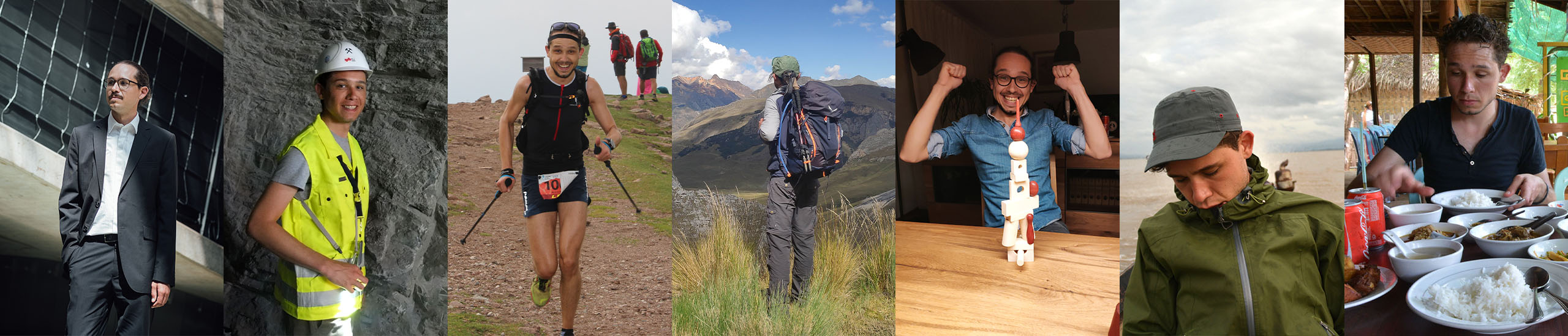
As I get older, I become increasingly aware of how lucky I am to be physically healthy and able to move freely around this world according to my desires and moods; yes, I can even subject my body to such a colossal project as crossing Austria.
Not everyone is blessed with this fortune. And some people, namely children, are even born with an illness; an incredibly tough start. Not only for the children but also for their families. There may be long hospital stays necessary, difficult operations, expensive medications and therapies, and support to cope with this even more colossal challenge. Then, if financially weak families additionally fall into financial distress, … it makes one’s heart freeze.
There are probably many illnesses that newborns have to endure. A friend’s child had a serious heart defect and had to undergo surgery on the 10th day of life. A hospital stay was necessary, far from home. However, in Austria, there is the non-profit association “Herzkinder Österreich” (Heart Children Austria), which operates so-called “Teddy Houses” in immediate proximity to two pediatric heart centers. In these, parents and also siblings of “heart children,” i.e., those children born with a heart defect, can find accommodation for the duration of the hospital stay and thus always stay close to their hospitalized children. And in such a Teddy House, the aforementioned friend with his wife and sibling were housed during this difficult time and received support, orientation, and humanity.
As soon as the idea of running across Austria came up, it quickly became very clear: I can use this action to draw attention to heart children and their needs. Perhaps a few euros can be raised, and “every euro helps,” as the association states on its homepage www.herzkinder.at.
The association president, Michaela ALTENDORFER (she\her), knows about my undertaking (you can certainly confirm the credibility of my fundraising campaign with her -> contact details see on the page Herzkinder Team under Board Members).
I will create a donation account for my project through the Herzkinder association (see “My campaign helps“) by early August. This ensures that everything is handled in a transparent and accountable manner. All donations go directly to the Herzkinder association.
Austrian Donation Quality Seal for Herzkinder Österreich:
The idea
Have you ever thought about crossing a country on foot? No? I have. During my South America trip in 2023, the idea came to me once while hiking, and since then, it hasn’t let go! Back home, I asked my trainer and physiotherapist: “Do you think it’s possible for me to cross Austria on foot?”. “Sure!” (or something like that) was the immediate response. From both of them. That’s enormously motivating. The AT:AK project was born (AT … Austria, AK … Alexander Kluckner).
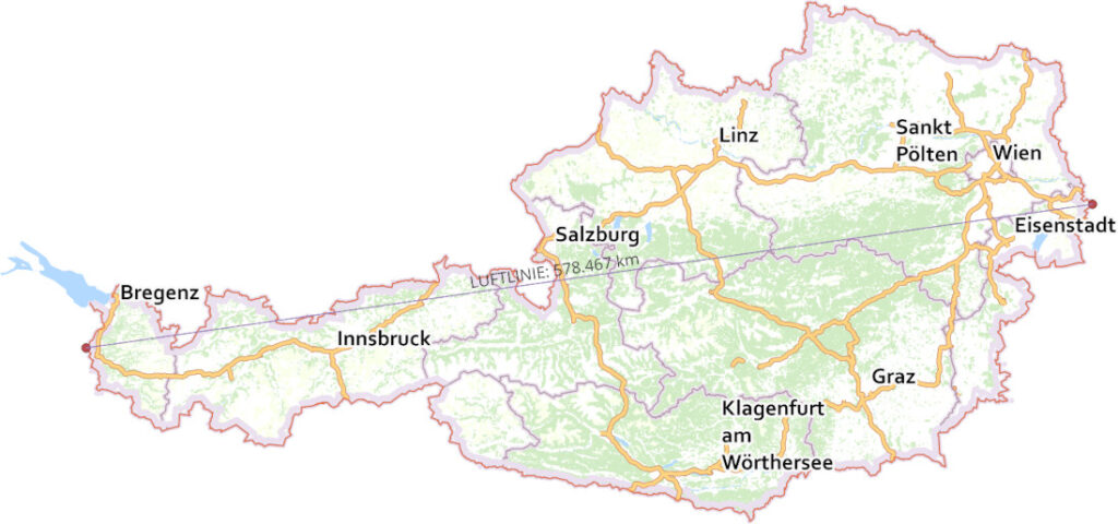
Okay, now what? First, clarify the distance. And which one? From my perspective, there’s only one correct answer: The distance between the two points furthest apart in Austria. The software QGIS and the freely accessible administrative base map of Austria (basemap.at) help with this. The result? Just under 579 km (as the crow flies), from the tri-border area Austria-Slovakia-Hungary near Deutsch Jahrndorf in the east to the tri-border area Austria-Liechtenstein-Switzerland near Bangs in the west.
That sounds manageable as I’ve already participated in ultramarathons with distances up to 90 km. It wasn’t until a few months later that I finally mapped out the route. With three premises: (1) No main roads, (2) stay close to the straight-line path, and (3) remain within Austria. Quickly during planning, I had to realize that the distance would be far greater than just under 600 km. Additionally, there will be a lot of elevation gain to overcome, although I deliberately avoided mountains and high-altitude trails so that (A) daily stages remain in a presumably manageable scope and (B) start and end points of daily stages are reachable by vehicle.
I’ll be sleeping in a motorhome that accompanies me throughout. No, it doesn’t drive itself. Family members who have volunteered to look after me on a weekly basis will take care of driving. Without family, something like this would be very difficult.
And what does the final route look like? I’ll reveal this much: It’s 17 stages totaling approximately 918 km and approximately 38,000 meters of elevation gain and loss (so, uphill and downhill, respectively). Each stage is over 45 km.
The start is planned for August 31, 2026. Will it be warm? Yes, mostly. Will it be exhausting? Absolutely. Why am I doing this? Because I can make it!
But ...
Like almost every other sport, running also carries a certain risk, especially when running off-road: the ankle twisting sideways on uneven surfaces and straining of the ligaments, or getting caught on a root or larger stone and stumbling or even falling. During long and/or multi-day runs, depending on conditions such as temperature, additional physical problems can occur: dehydration, nutrient deficiency, gastrointestinal complaints. What am I trying to say? I will prepare well and give my best. But nothing is certain, and I cannot guarantee that I will be able to carry out this undertaking until the end.
Professional support
I’m fortunate that, depending on where I happen to be living, I consistently find truly wonderful people who advise and support me with their professional expertise and experience. And they do so even outside of “business hours” when something is bothering or worrying me. Thank you so much, dear mentors! Below are the people who have been supporting me for a very long time or ever since my idea to cross Austria took shape:
- ARVAY Stefan (he/him): Sports scientist and my coach since 2021. Graz, Austria. Arvay Consulting: Homepage. Sportpark Athletikzentrum Graz: Homepage.
- BURTSCHER Cornelia (she/her): Massage therapist. I’ve been seeing her since August 2025. Nüziders, Austria. Druckpunkt Heilmassage: Homepage, Instagram.
- DAXBERGER Andreas (he/him): Sports physiotherapist and osteopath. Neither of us knows for sure, but we think I first visited him in 2014. Graz, Austria. Sportpark Athletikzentrum Graz: Homepage.
- HAUER Othmar (he/him): Physiotherapist. First ordination in October 2024. Zirl, Austria. Physiotherapie Hauer: Homepage.
- ROSENBERGER Ralf (he/him): Specialist in orthopedics, traumatology, and trauma surgery. First ordination in October 2024. Innsbruck, Austria. Ortho Unfall Tirol: Homepage.
Two friends
Two other important people in my life are Hannah and Steffi. They’re always there to listen to me and support me, even when things aren’t going quite the way I’d like them to. Hannah put together a great strength training program for me when I was really in a bind. Steffi has always been there to advise me on pharmaceutical issues. And I can also talk to both of them about nutrition and nutrients.
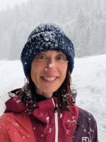
BUYER Hannah: An ambitious runner, hiker, and cyclist. A top-notch mom. A certified geologist. Currently training to become a registered nurse.
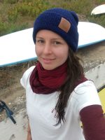
KOBERGER Stefanie: Top-notch pharmacist. Avid cyclist and surfer. Yoga teacher and mindfulness instructor (MBSR) with a passion (homepage). New mother of twins.
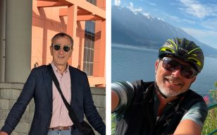
My cool uncles Karl and Kurt
Family
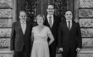
The right words? I can’t find them. No short paragraph would do it justice. I’ll try anyway: support — no matter when, no matter where, and no matter what it’s about. Over the past three years, there have been quite a few ups and downs, with a lot of emotions. And my family has been there with me. Always. And always supportive.
Father Helmuth, Mother Karoline, Brother Michael.
Thank you for that! ❤
The stages
Once I had the straight-line distance, I set out in March 2024 to plan the daily stages using Locus Map’s online route planner. I did so with a bit of naivety, a lot of motivation, and by following my gut. That’s the only reason there ended up being 17 stages, each over 45 km.
When you’re planning, raw numbers like 50, 60, or 70 don’t sound so bad. And those 38,000 hm didn’t seem real back then either. My euphoric brain was more like, “Umm, over 50 km, 3,000 m up and down, phew, yeah, I’ll be fine!” When planning each stage, I’d already visualized myself arriving at the finish line.
Well, it’s only now, in 2026, that I’m actually putting the scope of my project into practice firsthand during my test weekends (long runs of up to 43 km and some elevation gain over 3–4 consecutive days).
The routes themselves will be already a challenge because—apart from a few sections in Tyrol and Vorarlberg—I’m not familiar with the trails. So it’s possible that my stages will include sections that might not be passable at all, for example, because they run through private property that I’m not allowed to enter, or because they’re closed in August or September for some reason. That will require spontaneity on my part, even though such spontaneity will likely involve some detours. And those detours will take time and energy.
In any case, here are the stages:
- Table 1: The starting points of the stages.
- Table 2: The finishing points of the stages.
- Table 3: The distances, routes, and elevation profiles of the stages.
| Stage | Start | Link to Locus Map (route planner) | |||
|---|---|---|---|---|---|
| 01 | Bgld. | 2423 | Deutsch Jahrndorf | Skulpturenpark am Dreiländereck | N 48.006682°, E 17.160801° |
| 02 | NÖ | 2451 | Hof am Leithaberge | Naturpark Die Wüste Mannersdorf | N 47.958184°, E 16.587974° |
| 03 | NÖ | 2561 | Hernstein | Schloss Hernstein | N 47.898026°, E 16.100542° |
| 04 | NÖ | 3193 | Mitterbach in St. Aegyd am Neuwalde | Aufgelassener Bahnsteig Amt Mitterbach | N 47.870307°, E 15.598306° |
| 05 | NÖ | 3294 | Holzhüttenboden in Gaming | Oisbrücke | N 47.820010°, E 15.144653° |
| 06 | NÖ | 3343 | Hollenstein an der Ybbs | Landwirtschaftliche Fachschule Unterleiten | N 47.783750°, E 14.765115° |
| 07 | OÖ | 4581 | Rosenau am Hengstpaß | Hengstpasshütte | N 47.701946°, E 14.460695° |
| 08 | Stmk. | 8893 | Grundlsee | Göß am Grundlsee | N 47.638697°, E 13.902463° |
| 09 | Sbg. | 5441 | Abtenau | Postalm Restaurant Lienbachhof | N 47.648824°, E 13.432084° |
| 10 | Sbg. | 5761 | Hinterthal in Maria Alm am Steinernen Meer | Pfarrkirche Hinterthal | N 47.411536°, E 12.979156° |
| 11 | T | 6393 | St. Ulrich am Pillersee | Pfarrkirche Heiliger Ulrich | N 47.529351°, E 12.571734° |
| 12 | T | 6334 | Schwoich | Pfarrkirche Heiliger Ägidius | N 47.544608°, E 12.140499° |
| 13 | T | 6215 | Achenkirch | Badestrand Achensee Nord | N 47.500989°, E 11.706469° |
| 14 | T | 6108 | Scharnitz | Bergrettung Scharnitz | N 47.386227°, E 11.266689° |
| 15 | T | 6622 | Berwang | Bergrettung Berwang | N 47.408476°, E 10.750101° |
| 16 | T | 6652 | Elbigenalp | Freischwimmbad Elbigenalp-Bach | N 47.279429°, E 10.412700° |
| 17 | Vbg. | 6752 | Dalaas | Formarinalpe | N 47.172167°, E 10.000252° |
| Stage | Finish | Link to Locus Map (route planner) | |||
|---|---|---|---|---|---|
| 01 | NÖ | 2451 | Hof am Leithaberge | Naturpark Die Wüste Mannersdorf | N 47.958184°, E 16.587974° |
| 02 | NÖ | 2561 | Hernstein | Schloss Hernstein | N 47.898026°, E 16.100542° |
| 03 | NÖ | 3193 | Mitterbach in St. Aegyd am Neuwalde | Aufgelassener Bahnsteig Amt Mitterbach | N 47.870307°, E 15.598306° |
| 04 | NÖ | 3294 | Holzhüttenboden in Gaming | Oisbrücke | N 47.820010°, E 15.144653° |
| 05 | NÖ | 3343 | Hollenstein an der Ybbs | Landwirtschaftliche Fachschule Unterleiten | N 47.783750°, E 14.765115° |
| 06 | OÖ | 4581 | Rosenau am Hengstpaß | Hengstpasshütte | N 47.701946°, E 14.460695° |
| 07 | Stmk. | 8893 | Grundlsee | Göß am Grundlsee | N 47.638697°, E 13.902463° |
| 08 | Sbg. | 5441 | Abtenau | Postalm Restaurant Lienbachhof | N 47.648824°, E 13.432084° |
| 09 | Sbg. | 5761 | Hinterthal in Maria Alm am Steinernen Meer | Pfarrkirche Hinterthal | N 47.411536°, E 12.979156° |
| 10 | T | 6393 | St. Ulrich am Pillersee | Pfarrkirche Heiliger Ulrich | N 47.529351°, E 12.571734° |
| 11 | T | 6334 | Schwoich | Pfarrkirche Heiliger Ägidius | N 47.544608°, E 12.140499° |
| 12 | T | 6215 | Achenkirch | Badestrand Achensee Nord | N 47.500989°, E 11.706469° |
| 13 | T | 6108 | Scharnitz | Bergrettung Scharnitz | N 47.386227°, E 11.266689° |
| 14 | T | 6622 | Berwang | Bergrettung Berwang | N 47.408476°, E 10.750101° |
| 15 | T | 6652 | Elbigenalp | Freischwimmbad Elbigenalp-Bach | N 47.279429°, E 10.412700° |
| 16 | Vbg. | 6752 | Dalaas | Formarinalpe | N 47.172167°, E 10.000252° |
| 17 | Vbg. | 6800 | Nofels in Feldkirch | Dreiländereck bei Bangs (Ortsweiler) | N 47.270232°, E 9.532249° |
| Stage | Kilometers | Meters in altitude gain | Meters in altitude loss | Link to image file (jpg) |
|---|---|---|---|---|
| 01 | 58.2 | 470 | -384 | Route and elevation profile |
| 02 | 49.8 | 384 | -175 | Route and elevation profile |
| 03 | 49.6 | 1665 | -1546 | Route and elevation profile |
| 04 | 53.4 | 2191 | -1991 | Route and elevation profile |
| 05 | 50.6 | 2005 | -2253 | Route and elevation profile |
| 06 | 54.8 | 2943 | -2449 | Route and elevation profile |
| 07 | 58.5 | 2529 | -2800 | Route and elevation profile |
| 08 | 57.0 | 3753 | -3307 | Route and elevation profile |
| 09 | 68.4 | 4574 | -4716 | Route and elevation profile |
| 10 | 48.9 | 1333 | -1503 | Route and elevation profile |
| 11 | 48.5 | 3211 | -3484 | Route and elevation profile |
| 12 | 50.9 | 2221 | -1865 | Route and elevation profile |
| 13 | 62.2 | 2556 | -2521 | Route and elevation profile |
| 14 | 50.4 | 2745 | -2409 | Route and elevation profile |
| 15 | 46.4 | 2564 | -2816 | Route and elevation profile |
| 16 | 53.1 | 2217 | -1395 | Route and elevation profile |
| 17 | 53.4 | 1884 | -3319 | Route and elevation profile |
| Sum | 914.0 | 39,245 | -38,933 |